
Business Details
Professional Real Estate Photography Services in Greenville, SC
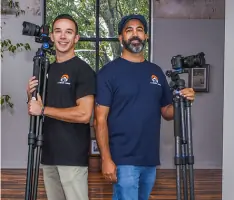
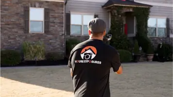
House Exposures is a professional real estate photography and aerial drone photography service operating throughout the Upstate of South Carolina. With expertise in residential and commercial real estate, architectural visualization, Airbnb/VRBO listings, and new construction documentation, we deliver high-quality visual content to enhance property marketing. Our FAA-certified drone operations provide unique aerial perspectives that highlight property features and proximity to landmarks. We specialize in MLS listings, cinematic video tours, and immersive 3D Matterport experiences that help properties stand out in competitive markets. Our team understands the critical role professional photography plays in real estate transactions, offering quick turnaround times and tailored solutions for real estate agents, property owners, and commercial clients.By combining technical precision with creative composition, we help clients maximize property exposure and achieve successful outcomes. Our services extend to Greenville and surrounding areas, supporting both traditional real estate transactions and vacation rental marketing. We maintain strict compliance with aviation regulations while prioritizing client satisfaction through consistent communication and reliable service delivery.
Services
Real Estate Photography
Aerial Drone Photography
3D Matterport Tours
Cinematic Video Tours
Commercial Property Imaging
Highlights and features
- FAA licensed and certified drone operators for compliant aerial photography
- Quick turnaround times for urgent listing requirements
- 3D Matterport tours providing immersive property experiences
- Proven track record with residential, commercial, and vacation rental properties
- Specialized understanding of real estate marketing requirements
Associations and certifications
- FAA
Services
Real Estate Photography
Professional still photography services for residential and commercial real estate listings. Our team captures interior and exterior spaces using calibrated equipment to ensure accurate color representation and composition. Services include standard MLS listings, high-end marketing packages, and specialized shoots for luxury properties. We follow industry best practices to showcase properties in their most appealing light while maintaining authenticity.
Aerial Drone Photography
FAA-compliant aerial photography using state-of-the-art drone technology. Our certified operators capture unique perspectives that highlight property dimensions, landscaping, and proximity to key landmarks. This service includes cinematic flyovers, property boundary documentation, and contextual shots showing neighborhood integration. All drone operations follow strict safety protocols and regulatory requirements for commercial airspace usage.
3D Matterport Tours
Immersive 3D scanning services creating interactive property experiences. Using Matterport Pro technology, we generate accurate spatial representations with navigable floor plans, dollhouse views, and measurement tools. These digital twins allow potential buyers to explore properties remotely while maintaining precise dimensional relationships. The service includes hosting and integration with major real estate platforms.
Cinematic Video Tours
Professional video production combining ground and aerial footage for dynamic property presentations. Our team creates polished marketing pieces featuring smooth transitions, ambient audio capture, and strategic shot sequencing. Videos are optimized for multiple platforms including social media, real estate portals, and agent websites to maximize viewer engagement and property interest.
Commercial Real Estate Imaging
Specialized visual documentation for commercial properties including office spaces, industrial facilities, and retail locations. Our services include before-and-after documentation for renovations, leasing package preparation, and marketing materials for property management companies. We accommodate large-scale projects with extended shoot times and customized deliverables to meet commercial real estate industry standards.
Questions
What areas do you service?
We operate throughout the Upstate of South Carolina, including Greenville, Spartanburg, and Anderson counties. Our drone capabilities allow efficient coverage of rural and suburban properties.
Are your drone operators certified?
Yes, all our drone pilots hold current FAA Part 107 certifications for commercial drone operations. We maintain full compliance with federal aviation regulations during all aerial photography sessions.
How long does a typical photo shoot take?
Residential shoots usually require 1-2 hours depending on property size. Commercial projects vary but average 2-4 hours. Aerial sessions add 30-60 minutes per property. We coordinate timelines with agent and homeowner schedules.
What deliverables can I expect?
Clients receive high-resolution digital images, aerial shots (when applicable), and access to 3D virtual tours. All files are delivered through an online portal with download options for MLS, websites, and print materials.
Do you offer rush services?
We prioritize urgent requests and often accommodate same-day or next-day shoots for active listings. Additional fees may apply for emergency scheduling outside regular business hours.
How do you prepare for a shoot?
We provide a preparation guide covering staging recommendations, lighting adjustments, and exterior maintenance tips. Our team coordinates directly with agents to ensure properties are show-ready before our arrival.